Mineral exploration Madagascar
Home
Introduction
Services
Project 
 Experience
List of 
 Clients
Project  
 Summaries
Photo 
 Galleries
Resumé
Contact
Links
African 
 Geologists
Downloads
Metal + Mineral 
 Prices
Deutsche Version, hier klicken
Version francaise en préparation

Copyright 2001 - 2015 by    Wolfgang Hampel
No part of the site may be reproduced without prior permission

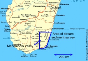
Stream sediment survey in south-eastern Madagascar (2005 - 2006)

Position held: Head of section Mining, Infrastructure and Mineral Exploration, Fugro Consult GmbH, Germany

Scope of project

Since 2003 the World Bank funds a major project in Madagascar to restructure the country’s minerals sector and to reinterpret the crystalline basement. The aim of the project is to provide digital geological maps and data for interested national and international mining companies and other interested parties. The structural and metallogenetic interpretation of the existing maps, based on work carried out by the geological surveys of Madagascar and France in the middle of the past century, are outdated.

madagascar_map

In this sub-project, an area of 150,000 km² is re-mapped on two scales and a 2,000 samples stream sediment survey is carried out on a 14,000 km² subset in the SE. The geochemical survey was designed by me and field work started in 2005. It will last until end 2006. More pictures are found in the photo galleries.

Services provided

  • Conceptual design of work program
  • Sampling of 2,000 stream sediment samples
  • Recovery of 2,000 panning concentrates and coarse fractions for the determination of the mineralogical composition
  • Description of outcrop geology and possible mineralization
  • Sample preparation in the field for chemical analysis
  • Statistical treatment of more than 60 different elements
  • Geological and geochemical interpretation of results
  • On-the-job-training of Malagasy counterpart geologists

Approach

Besides metasomatic and high-grade metamorphic sedimentary rocks, granitic rocks dominate the rugged south-east of the island. The region is known for primary sapphire and uranothorianite deposits. The ilmenite beach placers around Fort Dauphin (Tôlanaro) are amongst the most important in the world.
The geochemical prospection does not aim at a single mineral or chemical element, it is rather a tool to evaluate the overall mineral potential of the area. The georeferenced stream sediment samples are sieved to –80 mesh in the field. The fine fraction is submitted for chemical analysis, the panning concentrates and the coarse fraction are inspected visually for valuable minerals such as gold, colored gemstones or tantalite.

stream_sediment_map

Presentation of stream sediment survey results (detail)

The chemical analysis for gold, palladium and platinum is done by fire assay/ICP-ES. The easy soluble elements as copper, lead, zinc are analyzed by ICP-MS after aqua regia digestion. The refractory elements like REE, tantalum, tin, uranium are analyzed by Li-borate fusion/ICP-MS. The quality control of the laboratory is assured by the introduction of blank and duplicate samples.

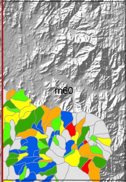
After a statistical treatment of the chemical analysis, the results are plotted on digital and analog maps which can be acquired after the project by mining and exploration companies.

Another important aspect of the project is the training of Malagasy counterparts in modern techniques of geochemical mineral exploration. In total, some 10 Malagasy geologists participate in the on-the-job-training.

stream_sediment_sampling

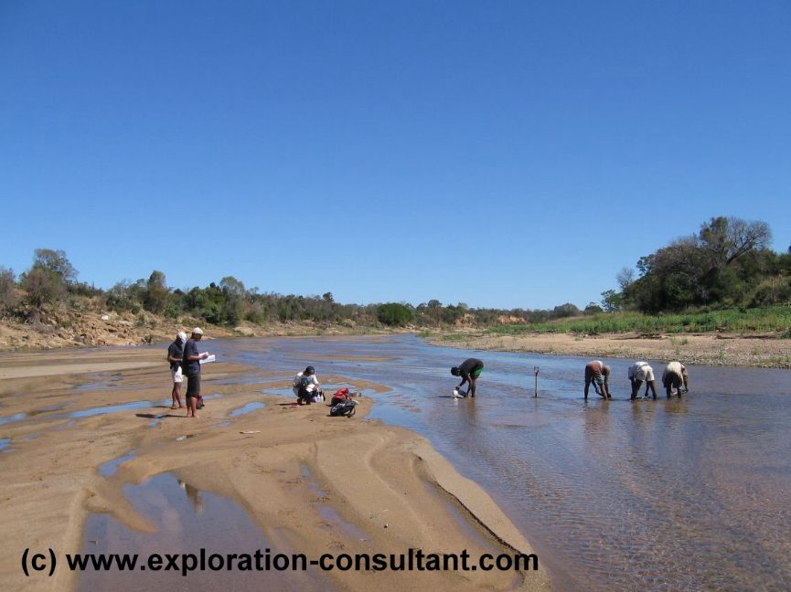
Stream sediment sampling at the Manambolo River, Madagascar